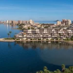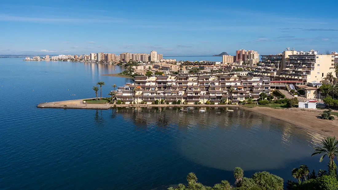
La Manga is a narrow spit of land on the Costa Cálida coast, separating the Mar Menor lagoon, whose name means ‘Little Sea’, from the Mediterranean Sea.
The famous La Manga is a place that can surprise you with its unusual appearance and geographical position. When you first see it on a map, you might think that someone has drawn this stretch of coastline rather carelessly. A narrow strip of land extends for more than 20 kilometres, separating the Mediterranean Sea from the vast Mar Menor lagoon.
The spit is so narrow that, while driving along the main road, you can see beaches on both sides. Despite its limited width, however, much of this strip of land is lined with tall apartment blocks and hotels. Imagine stepping out of your hotel in the morning and walking down to a beach beside a peaceful lagoon, then taking a short stroll to the other side of the peninsula in the afternoon to find yourself beside the open sea. Different waves, a different colour of water and an entirely different landscape. There are very few places on the Spanish coast quite like this.
La Manga is located in the Region of Murcia, in south-eastern Spain. It mainly attracts people looking for a beach holiday, although that certainly does not mean spending the entire stay on a sun lounger. There are several genuinely interesting places in the surrounding area worth exploring, including small marinas, fishing villages, natural beaches, nature reserves and restaurants serving traditional local dishes. If you are travelling to this part of Spain, it is worth setting aside at least one day for La Manga, although if you enjoy peaceful holidays by the water, you may find yourself wanting to stay much longer.
La Manga – essential information at a glance
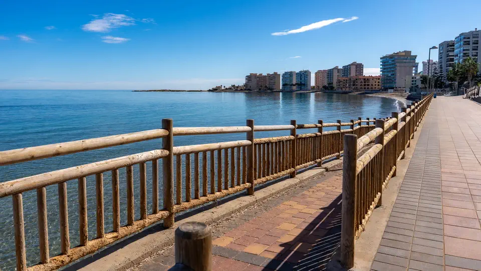
La Manga del Mar Menor is a coastal spit in the Region of Murcia, on the south-eastern coast of Spain. It is approximately 21 kilometres long and separates the saltwater Mar Menor lagoon from the Mediterranean Sea. It gradually developed over thousands of years through the action of waves, coastal currents and the accumulation of sand.
La Manga is famous for its long beaches on both sides of the spit. On one side, you can swim in the calmer waters of Mar Menor, while the other offers beaches facing the open Mediterranean. It is an excellent destination for relaxing by the sea and enjoying water sports, particularly sailing, windsurfing and kitesurfing.
There are plenty of interesting places to explore in the surrounding area. Highlights include the distinctive Puente de la Risa, the Puerto Deportivo Tomás Maestre marina and Cabo de Palos to the south, which is known for its lighthouse and marine reserve. The Calblanque Regional Park, with its beautiful natural beaches and dunes, is also nearby.
Mar Menor is an important part of the local landscape and the largest saltwater lagoon in Europe. Its shallow, relatively warm waters provide a habitat for numerous species of birds and marine life. Unfortunately, the lagoon has also been struggling with environmental problems, including pollution and the effects of intensive agriculture.
During your stay in La Manga, make sure you try the local speciality, caldero del Mar Menor, a traditional fish and rice dish. The most pleasant months to visit are May, June and September, when the weather is ideal for spending time on the beach and there are fewer visitors than during the height of the summer holidays.
Where is La Manga, what exactly is it and how did it form?
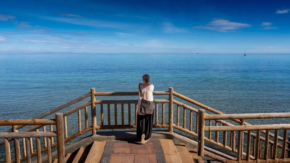
La Manga del Mar Menor lies on the coast of the Region of Murcia, between Cartagena and San Javier. Its name means ‘sleeve’ in Spanish, which is a remarkably accurate description of its shape. It is a long, narrow strip of land separating the Mar Menor lagoon from the Mediterranean Sea. The spit is approximately 21 kilometres long, although its width varies considerably along its length. In some places, it is particularly narrow, with only a few hundred metres separating the two shores, while other sections offer considerably more land.
The main road, Gran Vía de La Manga, runs along almost the entire length of the spit and takes you close to its northern tip. During the summer, however, you need to be prepared for traffic jams. The narrow strip of land, large numbers of cars and heavy holiday traffic can turn even a relatively short journey into a surprisingly long one. Just a few decades ago, this area was much wilder and sparsely populated. Everything began to change in the 1960s, when tourism development gathered pace. Hotels, apartment blocks, restaurants and marinas started appearing, and today La Manga is one of the best-known holiday resorts in the Region of Murcia.
The formation of La Manga is closely connected with the movement of the sea, coastal currents and sediments carried along the shoreline. Looking at a map of south-eastern Spain today, it is difficult to imagine that this distinctive narrow strip of land did not always exist. Thousands of years ago, the landscape was completely different. Instead of a spit separating two bodies of water, there was an open bay of the Mediterranean Sea.
It all began with geological processes that continued along this stretch of coastline for a very long time. Waves and marine currents constantly moved sand, gravel and fine sediments along the shore. Some of this material came from coastal erosion, while other deposits were transported by the water from different parts of the surrounding area. Gradually, the sediments began accumulating in places where the currents lost some of their energy.
Over time, sandy banks appeared and gradually grew larger. New layers of sand and sediment built upon the existing landforms, a process that continued for hundreds and eventually thousands of years. Eventually, a long natural barrier emerged, separating part of the bay from the open Mediterranean Sea. This was how La Manga was formed, creating a completely different landscape for the entire region. It was not the result of one dramatic geological event, but rather the slow and persistent work of the sea over countless generations.
Initially, the spit was not a continuous strip of land. Instead, it consisted of sandy islands, banks and small stretches of dunes, with water still flowing freely between them. Gradually, these separate sections began to join together. The wind carried sand further inland, while dune vegetation helped trap additional deposits. Little by little, the coastline became more solid and continuous.
The separation of the bay from the open sea led to the formation of Mar Menor. However, this does not mean that the lagoon became completely enclosed. Natural channels, known in Spanish as golas, still allow water to flow between the lagoon and the Mediterranean Sea. These passages maintain the connection between the two bodies of water and allow an exchange of water to take place.
It is worth remembering that La Manga is a natural geological formation, although its present-day appearance has been considerably altered by human activity. During the first half of the 20th century, dunes, sandy landscapes and small settlements dominated the area. Intensive tourism development began in the 1960s, bringing new roads, hotels, apartment buildings and holiday facilities. Many natural sections of the spit were built over, while some of the original dune systems were transformed.
Today, La Manga is an excellent example of how natural forces can reshape an entire coastline over thousands of years. When walking along its beaches, it is worth remembering that the ground beneath your feet was created through the constant movement of sand, waves and wind. These natural processes produced one of the most distinctive landscapes on the Spanish coast.
Two seas – the greatest attraction of La Manga
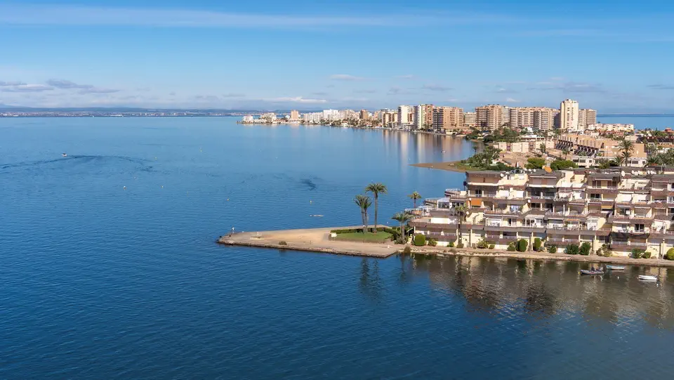
The presence of two different bodies of water is precisely what makes La Manga so interesting. On one side lies the Mediterranean Sea, while on the other is Mar Menor. You only need to cross the narrow strip of land to notice the difference.
The Mediterranean is more exposed to the open sea. The waves can be considerably larger, and the water is sometimes cooler. This is the kind of coastline familiar from many Spanish holiday resorts, with wide beaches, sand, the sound of the waves and plenty of space for a long walk.
Mar Menor looks completely different. It is a vast lagoon with much calmer water. You will not find waves here like those on the other side of the peninsula, and the shallow bays warm up quickly under the summer sun. This is why families with children often choose the beaches along the lagoon. There is one more thing worth bearing in mind: the wind can change conditions on both shores. Before heading to the beach, check the forecast. Sometimes driving for just a few minutes is enough to find a much more pleasant place for a swim.
Beaches in La Manga – which one should you choose?
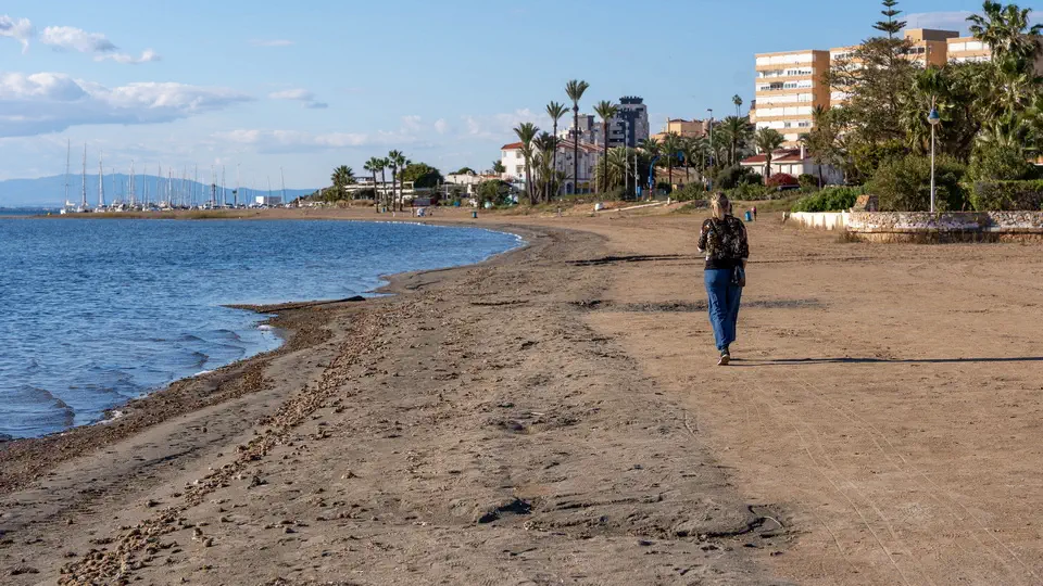
If you are coming here for a holiday, the choice of beaches is unlikely to disappoint you. There are plenty of them, and each part of the spit has its character. One of the best-known is Playa Galúa, located on the Mediterranean side. It is a typical holiday beach with light-coloured sand and good facilities. It can get quite busy during the summer, so if you prefer somewhere quieter, arriving in the morning is a good idea.
Another interesting option is Cala del Pino, a small beach beside Mar Menor, surrounded by pine trees. Their shade can be particularly welcome on hot days. It is a pleasant place to stop for a while, especially if you have had enough of sitting in the full sun. You should also visit Playa Veneziola in the northern part of La Manga. This area is somewhat quieter and has a more open feel. It is a good place for a walk, a little time beside the water and a glimpse of a less developed section of the peninsula.
Playa Mistral, meanwhile, lies on the Mar Menor side. Its calmer water and proximity to the resort make it popular with people who want to combine swimming with convenient access to restaurants and shops. I would not limit myself to just one beach. During your stay, it is worth visiting several, as each reveals a slightly different side of La Manga.
If you are planning to spend more time in this part of Spain and are looking for beautiful beaches, have a look at our guide to the best beaches on the Costa Blanca. You will find plenty of information about some of our favourite places along this stretch of coastline.
Puente de la Risa – the bridge that makes you smile
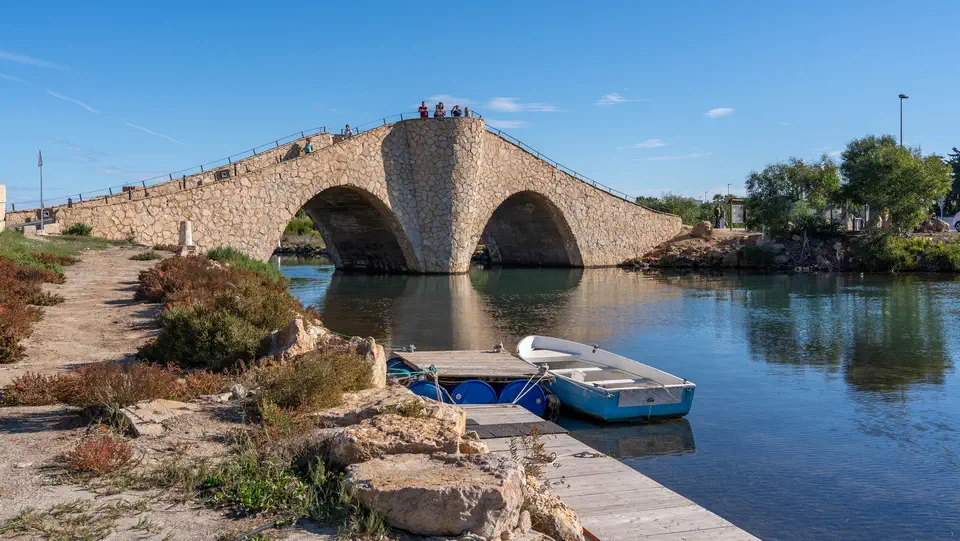
In the northern part of La Manga, there is a place that might seem rather unremarkable at first. It is called Puente de la Risa, which translates as the Bridge of Laughter. It is neither a monumental structure nor a historic landmark that deserves a major detour during your journey. Nevertheless, the bridge has become one of the area’s local curiosities, largely because of its unusual shape.
The structure has a distinctive, sharply curved hump. When driving across it, you may feel as though you are going over a small hill on a roller coaster. That is where its name comes from. It is worth stopping nearby and looking at the bridge from the side, as this is when its unusual profile becomes particularly clear. It is only a short stop, but if you are exploring the northern part of the spit, it would be a shame to miss it.
Puerto Deportivo Tomás Maestre – a marina, yachts and restaurants
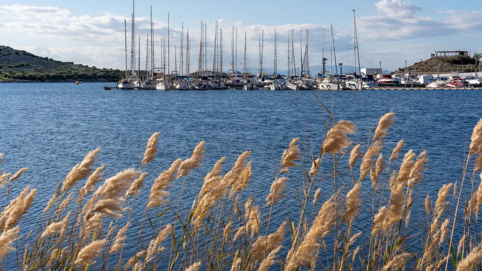
One of the most pleasant places for a stroll is Puerto Deportivo Tomás Maestre, a large marina in the northern part of La Manga. Yachts, motorboats and smaller vessels sailing on the waters of Mar Menor are moored here. The marina has a distinctly holiday atmosphere, with restaurants, bars and cafés where you can sit down for a coffee or enjoy something to eat. I like places like this because they offer a welcome change from spending the entire day on the beach. You can walk between the boats, watch the water and simply take a break.
Late afternoon is probably the best time to visit. The sun is no longer quite so intense, while the marina gradually fills with people returning from the beaches and boat trips. If you would like to see Mar Menor from a different perspective, it is also worth looking into the possibility of taking a boat trip.
Cabo de Palos – a small town with a maritime character
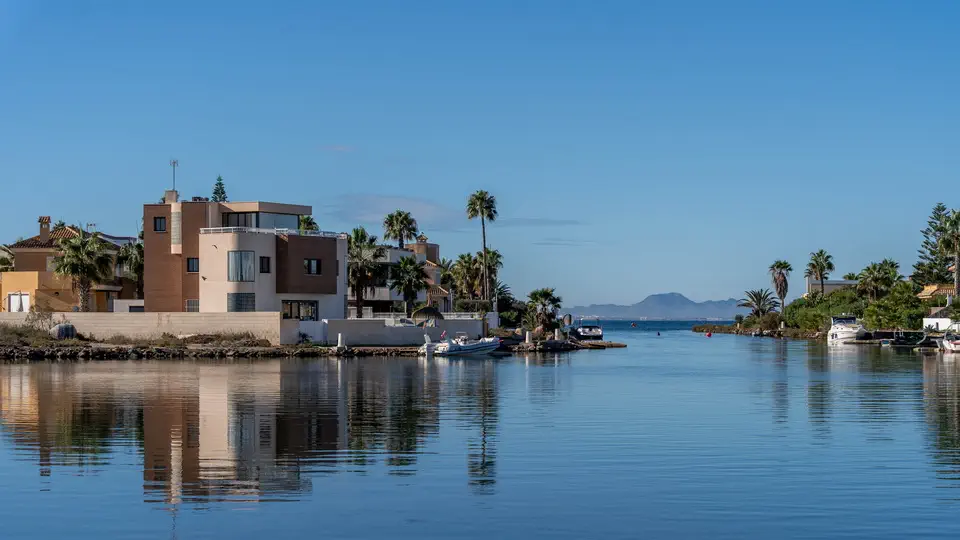
Do not limit your sightseeing to La Manga itself. At the southern end of the spit lies Cabo de Palos, a small town with a completely different atmosphere from the large holiday resort. The best place to start is the harbour, where you can see fishing boats, yachts and vessels used for diving excursions. There are several restaurants in the surrounding streets where you can try fresh fish and seafood. Some have tables overlooking the harbour, allowing you to enjoy lunch while watching everyday life in the town.
The Cabo de Palos lighthouse rises above the surrounding landscape. It stands on a rocky headland and is one of the most recognisable landmarks along this stretch of coast. It is worth walking towards it, even if you are not planning a lengthy sightseeing trip. The views across the sea and rocky shoreline are genuinely beautiful.
Cabo de Palos has another advantage. Nearby is the Cabo de Palos–Islas Hormigas Marine Reserve, a place well known among divers for its rich underwater world. If you are interested in snorkelling or scuba diving, you will find local diving schools and excursion operators in the area. The town itself is best explored without rushing. Spend some time by the harbour, walk along the coastline and perhaps stop at one of the restaurants. You do not need an entire day, but it is certainly worth setting aside a few hours.
Calblanque Regional Park – a wholly different side of the coastline
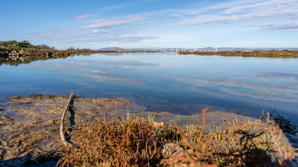
If you fancy a break from hotels and apartment blocks, head to Parque Regional de Calblanque. It is one of the most interesting natural areas in the vicinity of La Manga, and the landscape changes completely once you arrive. Instead of urban development, you will find dunes, sandy beaches, small coves and hills descending towards the sea. It no longer feels as though you are in a large holiday resort. There is space, tranquillity and considerably more natural scenery.
I particularly recommend Calblanque to anyone who enjoys walking. You can follow the coastline, find a quiet spot on the beach and spend a few hours away from the crowds. However, remember that this is a protected natural area. During the summer, the authorities may restrict vehicle access and introduce special entry arrangements. Check the latest information before setting off, and do not assume that you will be able to park directly beside whichever beach you choose.
What to eat in La Manga? Try traditional caldero

A Spanish holiday would not be complete without sampling the local cuisine. Around La Manga, you should pay particular attention to fish dishes and seafood, as well as the local tapas, which can be surprisingly varied. However, there is one particular dish I would strongly recommend trying: caldero, a traditional speciality from the Region of Murcia. Its main ingredient is rice cooked in a rich fish stock, accompanied by fish, garlic and spices. The result is a distinctive flavour that is quite different from the familiar paella.
The dish originated in the local fishing community. In the past, fishermen prepared it using fish that were not always suitable for sale. Over time, this simple meal became one of the region’s culinary symbols. Alongside caldero, try some fresh fish, seafood or, as mentioned earlier, local tapas. I particularly recommend the restaurants in Cabo de Palos. Around the harbour, you will find plenty of places where you can enjoy a good meal without having to look for an expensive or particularly formal restaurant.
And here is one more piece of advice: do not rush your evening meal. Spaniards often sit down to dinner quite late, treating it as an opportunity to meet friends and enjoy a conversation. It is worth adapting to this rhythm at least once during your stay.
Mar Menor – a natural treasure of the Region of Murcia
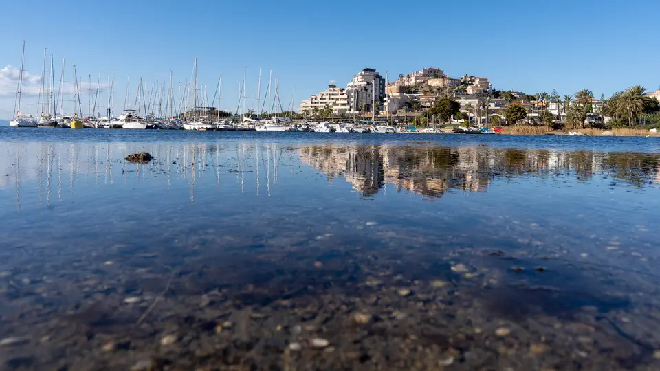
La Manga is about much more than beaches and tourism. It is also worth having a closer look at Mar Menor itself. It is the largest saltwater lagoon in Europe, covering an area of approximately 170 km². The La Manga spit separates it from the Mediterranean Sea. There are several small islands within the lagoon, some of which are volcanic in origin. You can see them during organised boat trips. The best known is Isla del Barón, which stands out because of its distinctive cone-shaped profile.
The surrounding area is also important for birdlife. Flamingos, herons and many other waterbirds can be found around the wetlands and marshes. If you enjoy wildlife watching, head towards the salt flats and wetland areas. I particularly recommend the surroundings of Salinas de Marchamalo and San Pedro del Pinatar. You can also read our article about San Pedro del Pinatar and its attractions. It is an excellent addition to a trip to La Manga.
However, it is important to mention the lagoon’s environmental problems. Mar Menor has been struggling with water pollution and a disruption of its natural ecological balance for many years. Factors contributing to the situation include fertiliser run-off from surrounding agricultural land and intensive human activity. Conditions change over time, so before swimming, it is worth checking the latest official information about water quality.
La Manga – practical information to help you plan your trip
- La Manga has a mild climate and can be visited throughout much of the year. However, this does not mean that every month is equally suitable for a holiday.
- July and August are the peak of the tourist season. It is hot, the beaches fill up with visitors, and restaurants and bars are operating at full capacity. This is a good time for anyone who enjoys a lively holiday atmosphere, although you should be prepared for traffic jams and more difficult parking. Personally, I would choose May, June or September. Temperatures are pleasant, the days are still long and the beaches are usually less crowded. In September, the water in Mar Menor can still be remarkably warm.
- October can also bring some pleasant surprises in terms of the weather. Autumn in this part of Spain often feels more like summer, making it possible to enjoy walks, explore the surrounding area and, when conditions are favourable, go swimming.
- La Manga looks rather different in winter. The resort becomes noticeably quieter, and some restaurants and tourist facilities reduce their opening hours or close for the season. Nevertheless, you can still enjoy walks and plenty of sunshine. If you are not particularly interested in a traditional beach holiday, winter can be an interesting time to visit as well.
- The most convenient way to explore La Manga is by car. Having your own transport gives you considerably more freedom, especially if you are planning to visit Cabo de Palos, Calblanque and other places around Mar Menor.
- The distance from Alicante to La Manga is approximately 110 kilometres. The drive takes around an hour and a half, although during the peak season you should allow extra time for traffic. Cartagena is much closer, with the journey taking approximately 30–45 minutes, depending on your destination.
- If you are arriving by plane, you can use Región de Murcia Airport in Corvera or Alicante–Elche Airport. The latter generally offers a wider choice of international connections.
- The main road leading onto and along the spit is Gran Vía de La Manga. It stretches along almost the entire peninsula. Remember that this narrow strip of land is not particularly suitable for quick journeys during the height of the tourist season. If you have a restaurant booking or an excursion planned, do not leave your journey until the last minute.
A few final thoughts
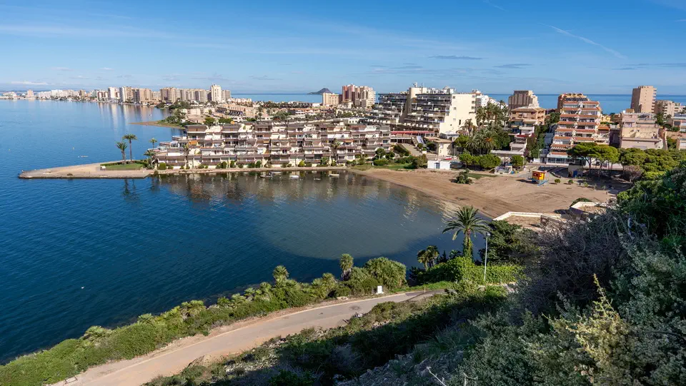
In my opinion, La Manga is definitely worth visiting, particularly outside the main tourist season, when the beaches and streets are considerably less crowded. However, it is not a destination for everyone. If you are looking for a small, peaceful town far removed from mass tourism, some parts of La Manga may disappoint you. The buildings are very densely packed in places, and during the summer the crowds can become rather overwhelming. But there is another side to this destination. Where else can you swim in a peaceful lagoon in the morning and spend the afternoon walking beside the open Mediterranean Sea? Add to that the interesting marinas, small fishing towns, natural beaches and excellent local cuisine.
I would not spend the entire holiday inside the hotel. It is worth driving along the spit from one end to the other, stopping at Puente de la Risa, visiting Tomás Maestre marina and setting aside a few hours for Cabo de Palos. If you have more time, make sure you plan a trip to Calblanque. La Manga is a good choice for a family holiday, but it can also make a very interesting stop on a longer road trip through southern Spain. Magda thought La Manga was one of the more interesting places along this stretch of the Spanish coast, and I have to agree with her.
If you are planning to explore this part of the country, I also recommend reading our guides to the attractions of the Costa Blanca and Torrevieja. Both destinations can easily be combined with a trip to the Region of Murcia. La Manga does not have to be the main destination of your entire holiday; it can be a fascinating stop along the way. One thing is certain: the sight of two seas on opposite sides of a narrow strip of land is something you will remember for a long time.
La Manga information and interesting facts
La Manga del Mar Menor is one of the most unusual places on the Spanish coast. Its narrow spit, two different seas, sandy beaches and small marinas make it difficult to confuse with any other holiday resort. However, La Manga has much more to offer than first meets the eye, including some fascinating stories and lesser-known details. Here are 20 interesting facts worth discovering before travelling to this corner of the Region of Murcia.
- La Manga means ‘sleeve’ in Spanish. The name is no coincidence. The long, narrow strip of land resembles a sleeve extending into the sea. The spit separates the Mar Menor lagoon from the open Mediterranean and stretches for approximately 21 kilometres.
- La Manga was created by coastal currents. Thousands of years ago, there was an open bay in this location. Coastal currents gradually transported sand and sediments, which accumulated along the shoreline. In this way, a natural strip of land developed, eventually separating part of the water from the Mediterranean Sea.
- You can swim in two different seas on the same day. This is one of La Manga’s greatest attractions. The open Mediterranean lies on one side of the spit, while the calmer Mar Menor lagoon is on the other. A short walk is all it takes to change beaches and find yourself beside a wholly different body of water.
- Mar Menor is the largest saltwater lagoon in Europe. It covers approximately 170 km² and has a very distinctive ecosystem. The water is relatively shallow, which means it warms up quickly during the summer. In many places, you can walk a considerable distance into the lagoon before reaching deeper water.
- The water in Mar Menor is saltier than the Mediterranean. This is mainly due to high temperatures, intense evaporation and the relatively limited exchange of water with the open sea. Minerals and salts remain in the lagoon, resulting in a comparatively high level of salinity.
- There are five volcanic islands in the lagoon. They are Isla del Barón, Isla Perdiguera, Isla del Ciervo, Isla del Sujeto and Isla Redonda. Their geological origins are a reminder of the fascinating volcanic history of the Murcia region. The islands are also an important part of the Mar Menor landscape.
- Isla del Barón is the largest island in Mar Menor. It is also known as Isla Mayor. The island is privately owned and is not a typical tourist attraction that visitors can explore freely. Its distinctive shape can be seen from many places along the lagoon.
- La Manga was not always a popular holiday resort. During the first half of the 20th century, the spit was considerably wilder and largely undeveloped. Dunes, sandy areas and natural coastal landscapes dominated the scenery. Intensive tourism development only began in the 1960s.
- There is one main road running along almost the entire spit. Gran Vía de La Manga stretches along most of the peninsula and provides access to its northern sections. During the summer, the road can become extremely busy because most vehicle traffic is concentrated along this single route.
- Puente de la Risa is one of the most unusual bridges in Spain. Its name translates as the Bridge of Laughter. The structure has a distinctive, sharply curved profile, making the drive across it feel rather like going over a small hill on a roller coaster. It has become one of the area’s most popular photographic curiosities.
- La Manga is popular with water sports enthusiasts. The calm waters of Mar Menor are particularly suitable for learning windsurfing, kitesurfing and sailing. Conditions are especially attractive for beginners because the lagoon is sheltered from the larger waves of the open sea.
- One of Spain’s most interesting marine reserves is located nearby. Cabo de Palos–Islas Hormigas is a protected marine area known for its rich underwater world. Numerous fish species can be found here, while the underwater landscapes attract divers from different parts of Europe.
- The Cabo de Palos lighthouse is more than 150 years old. It was first illuminated in 1865 and remains one of the most recognisable landmarks around La Manga. It stands on a rocky headland offering beautiful views across the Mediterranean Sea.
- La Manga is an important destination for birdwatchers. Flamingos, herons and numerous migratory bird species can be spotted in the surrounding wetlands, salt flats and shallow waters. The area around San Pedro del Pinatar is particularly interesting, with its extensive wetland habitats.
- You can still see traditional salt flats in the area. Salinas de Marchamalo is a reminder of the long-established tradition of salt production in the Region of Murcia. Salty water, shallow evaporation ponds and distinctive landscapes create an interesting habitat for birds and other organisms adapted to highly saline conditions.
- Caldero del Mar Menor is a local culinary speciality. This traditional fisherman’s dish is prepared with rice, fish, garlic and an aromatic stock. In the past, fishermen cooked it using fish that were not suitable for sale. Today, it is one of the best-known culinary symbols of the Region of Murcia.
- La Manga has more than 40 kilometres of beaches on both sides of the spit. They vary considerably in character. The beaches facing the Mediterranean are more exposed to waves, while those beside Mar Menor offer calmer water and gentler access to the sea.
- Calblanque Regional Park is located close to La Manga. It is one of the most valuable natural areas in the Region of Murcia. Visitors can discover natural dunes, wild beaches, small coves and hills descending towards the sea. Unlike the heavily developed parts of La Manga, the landscape here has retained a much more natural character.
- Mar Menor is struggling with serious environmental problems. Excessive fertiliser run-off from surrounding agricultural land, urban development and human pressure have disrupted the lagoon’s ecological balance. Particularly dramatic events occurred in 2019 and 2021, when huge numbers of dead fish appeared along its shores.
- La Manga is popular outside summer too. Thanks to the mild climate of the Region of Murcia, the area can also be visited in autumn and winter. October temperatures often remain warm enough for spending time on the beach, while outside the main season it is easier to find quiet places for walking and enjoying the coastline.